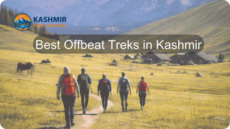
Introduction: Kashmir’s Ancient Trekking Heritage
Kashmir’s trekking trails are not merely pathways through stunning landscapes—they are ancient corridors of history, culture, and spiritual significance. Trekking in Kashmir dates back to ancient times when nomadic tribes including the Gujjars and Bakerwals used to traverse these mountains in search of grazing lands for their livestock. These routes, carved by centuries of seasonal migrations, trade caravans, and pilgrimages, have evolved into some of the most accessible and beginner-friendly trekking destinations in the Indian Himalayas.
For more than a thousand years, people traveled along these routes for trade, livelihood, adventure, and for sharing ideas. The Kashmir Valley’s strategic location along the historic Silk Road meant that these mountain passes witnessed the exchange of goods, cultures, and philosophies between Central Asia, Tibet, and the Indian subcontinent.
Historical Context: The Living Routes of Kashmir
The Silk Road Connection
One of the major routes along the historic Silk Roads connecting the West and the East passed through Kashmir and the Tibetan plateau. These ancient trade routes facilitated not just commerce but the spread of Buddhism, Islam, and various artistic traditions. The Kashmir-Tibetan Plateau route led to the adoption of Persian ornament patterns in carpet weaving, painting, and calligraphy, creating a rich cultural tapestry that trekkers can still witness in the region’s traditional villages.
The influence of these historical trade routes is evident in the architectural styles, local crafts, and cultural practices found in trekking base camps like Pahalgam, Sonamarg, and Aru Valley. Modern trekkers following these ancient paths walk in the footsteps of merchants, pilgrims, and explorers who shaped Kashmir’s multicultural identity.
The Nomadic Shepherds: Guardians of the Trails
The Bakarwals are traditionally pastoral nomads known for seasonally migrating with their livestock in search of suitable grazing pastures, moving between high-altitude meadows in summer and lower-altitude areas during winter. These migrations can cover nearly 300 kilometers on foot, taking 27 days, traversing the same mountain passes that modern trekkers now explore.
The trekking trail of the Great Lakes trek passes through the ancient trade route taken by shepherds of the region. These nomadic communities—primarily the Gujjars and Bakerwals—have maintained their traditional seasonal migrations for centuries, creating and preserving the very trails that now serve trekkers. Their intimate knowledge of weather patterns, safe passages, and medicinal plants has been invaluable in developing organized trekking routes.
The Gujjar-Bakerwal community, listed as a Scheduled Tribe in 1991, represents one of the largest Muslim tribal communities in Jammu and Kashmir. Their traditional lifestyle, practically unchanged for centuries, offers trekkers fascinating insights into Kashmir’s pastoral heritage. During summer treks, visitors often encounter these shepherds in high-altitude meadows, where they offer traditional hospitality and share stories passed down through generations.
The Pilgrimage Routes
Kashmir’s trekking heritage is deeply intertwined with its spiritual significance. The Amarnath pilgrimage has been a continuing tradition for Hindus for the last 300 years, though references to the cave temple date back much further. Ancient Sanskrit texts including the 6th-7th century Nilamata Purana and the 12th century chronicle Rajatarangini mention the cave temple and pilgrimage.
The Rajatarangini mentions the Sheshnag Lake, describing it as falling on the yatra route—the same lake that trekkers visit today on the Pahalgam route. The pilgrimage became widely recognized during the reign of King Zain-ul-Abidin in the 15th century and grew in importance during the Dogra period in the 19th century.
The Amarnath Yatra, though classified as a moderate to difficult trek, exemplifies how Kashmir’s trekking routes serve dual purposes—spiritual pilgrimage and adventure tourism. This integration of the sacred and the recreational characterizes many of Kashmir’s trekking destinations.
Geography and Landscape: Understanding Kashmir’s Trekking Terrain
The Pir Panjal Range
The Pir Panjal Range forms the southwestern barrier of the Kashmir Valley, creating the dramatic backdrop for most beginner-friendly treks. This mountain range, part of the Lesser Himalayas, reaches elevations of 4,000-5,000 meters and houses numerous alpine lakes, meadows, and glaciers. The range’s unique geography creates a rain shadow effect, blocking monsoon clouds and providing dry, comfortable trekking conditions from June to September.
The Pir Panjal’s geological composition includes limestone caves (like Amarnath), glacial valleys, and sedimentary rock formations dating back millions of years. Understanding this geology helps trekkers appreciate the landscape’s evolution and the natural forces that shaped these valleys and passes.
The Valley System
The valley is made of a similar disposition of vale and mountains, consisting of series of mountain ranges running mostly in parallel lines from south-west to north and east, separated by glens which are in general of no great breadth. This parallel valley system creates natural trekking corridors that are relatively accessible while offering spectacular mountain views.
The chief peculiarity by which Kashmir geography is distinguished from the mountain countries on its confines is the richness of its vegetation. Unlike the stark landscapes of Ladakh to the north, Kashmir’s valleys support dense forests of pine, fir, spruce, and deodar, creating diverse ecosystems at different altitudes.
The Alpine Lakes
The series of mountains contiguous to the Kashmir valley has given birth to various lakes of unreliable high altitudes encircled by well-preserved mountainscape with glacier waters. These alpine lakes—including Tarsar, Marsar, Vishansar, Krishansar, Gangabal, and Tulian—are the jewels of Kashmir trekking. Formed during the last ice age and fed by snowmelt and glaciers, these turquoise gems sit in glacial cirques surrounded by meadows and rocky peaks.
Detailed Trek Profiles: Historical and Contemporary Perspectives
1. Tulian Lake Trek: The Beginner’s Paradise
Historical Context: Tulian Lake has served as a summer pasture for Gujjar shepherds for centuries. The lake’s name derives from local folklore, and the surrounding meadows have witnessed seasonal migrations since time immemorial. British colonial officers in the late 19th century documented this route, noting its relative accessibility compared to other Kashmir treks.
Detailed Profile:
- Starting Point: Pahalgam (2,130m) – “Valley of Shepherds”
- Maximum Altitude: 3,685 meters (11,200 feet)
- Total Distance: 32 km round trip
- Duration: 3-4 days
- Difficulty: Easy to Moderate
- Best Season: June to September
- Trek Grade: Suitable for first-time trekkers with basic fitness
Day-by-Day Itinerary:
Day 1: Pahalgam to Deno Valley (4.5 km, 3-4 hours)
- Altitude gain: 2,130m to 2,800m (670m ascent)
- Trail type: Forest path through pine and fir
- Highlights: Lidder River views, Gujjar settlements
- Camp: Deno Valley meadow
The trek begins from Pahalgam’s main market, following the Lidder River upstream. The well-marked trail ascends gradually through dense coniferous forests. Trekkers often encounter Gujjar families in traditional log huts, offering fresh milk and insights into their nomadic lifestyle. The forest canopy provides shade, making this a comfortable first day.
Day 2: Deno Valley to Tulian Valley (4 km, 3-4 hours)
- Altitude gain: 2,800m to 3,300m (500m ascent)
- Trail type: Mixed forest and open meadows
- Highlights: Changing vegetation zones, birdwatching
- Camp: Tulian Valley base
This section transitions from forest to alpine meadows. The trail becomes steeper but remains well-defined. Trekkers cross small streams fed by snowmelt and encounter shepherds grazing their flocks. The campsite at Tulian Valley offers panoramic views of surrounding peaks and serves as the base for the summit push.
Day 3: Tulian Valley to Tulian Lake and Return (8 km, 6-7 hours)
- Altitude gain: 3,300m to 3,685m (385m ascent)
- Trail type: Boulder fields and scree
- Highlights: Figure-eight shaped lake, floating ice, 360° mountain views
The final ascent involves navigating boulder fields and loose scree—the trek’s most challenging section. Early morning starts (5-6 AM) are recommended to avoid afternoon weather changes. The lake appears suddenly as trekkers crest the final ridge, its distinctive figure-eight shape framed by snow-covered peaks. Even in July-August, ice chunks float on the turquoise waters. The return to Tulian Valley camp takes 3-4 hours.
Day 4: Tulian Valley to Pahalgam (8.5 km, 3-4 hours)
- Descent back to Pahalgam via same route
Cultural Encounters: Interaction with Gujjar shepherds provides cultural depth. These communities maintain traditional practices including:
- Handmade wool clothing and blankets
- Traditional medicine using local herbs
- Gojri language and folk music
- Seasonal migration patterns
- Animal husbandry techniques
Flora and Fauna:
- Lower forests (2,130-2,500m): Pine, fir, spruce, horse chestnut
- Middle elevation (2,500-3,000m): Silver birch, Himalayan maple, rhododendron
- Alpine zone (3,000m+): Wildflowers (July-August) including primulas, gentians, potentillas
- Wildlife: Himalayan marmots, pikas, Kashmir flying squirrel, golden eagles, Himalayan griffon vultures
Practical Information:
- Trek difficulty factors: Altitude gain, boulder navigation, unpredictable weather
- Acclimatization: One day in Pahalgam recommended
- Group size: Ideal 4-8 trekkers
- Guide requirement: Recommended but not mandatory for experienced trekkers
- Permit: No special permits required for Indian nationals
- Cost estimate: ₹12,500-17,500 per person (group bookings)
2. Tarsar Marsar Trek: The Twin Jewels
Historical Significance: Tarsar and Marsar lakes have been sacred sites for local communities for centuries. The name “Tarsar” possibly derives from Sanskrit terms meaning “star lake,” while “Marsar” means “snake lake” in local dialect. These lakes feature in Kashmiri folklore and traditional songs, representing the region’s spiritual connection with high-altitude water bodies.
Detailed Profile:
- Starting Point: Aru Valley (2,500m)
- Maximum Altitude: 4,100 meters (Sundarsar Pass)
- Total Distance: 48 km
- Duration: 6-7 days
- Difficulty: Moderate
- Best Season: July to September
- Trek Grade: Requires good fitness and some trekking experience
Complete Itinerary:
Day 1: Srinagar to Aru Valley
- Drive: 95 km, 3-4 hours
- Altitude: 1,585m to 2,500m
- Activities: Acclimatization walk, equipment check, briefing
Day 2: Aru Valley to Lidderwat (9 km, 4-5 hours)
- Altitude gain: 2,500m to 2,950m (450m)
- Trail type: River valley path
- Highlights: Lidder River, pine forests, meadows
The trek follows the Lidder River through lush valleys. The well-graded path passes through shepherd settlements and offers views of surrounding peaks. Lidderwat (“meadow of the Lidder”) is a vast campsite with grazing ponies and spectacular sunsets.
Day 3: Lidderwat to Shekhawas (7 km, 5-6 hours)
- Altitude gain: 2,950m to 3,350m (400m)
- Trail type: Gradual ascent through meadows
- Highlights: Wildflower displays, nomadic settlements
This section showcases Kashmir’s famous meadows. In July-August, the landscape explodes with wildflowers—gentians, primulas, edelweiss, and alpine forget-me-nots. Gujjar settlements dot the meadows, where shepherds offer fresh dairy products.
Day 4: Shekhawas to Tarsar Lake (4 km, 3-4 hours)
- Altitude gain: 3,350m to 3,800m (450m)
- Trail type: Steep final ascent
- Highlights: First glimpse of Tarsar Lake
The short but steep climb rewards with Tarsar Lake’s vast expanse. The lake, over 1 km long, reflects surrounding peaks like a mirror. The campsite sits on the lake’s edge, offering sunrise and sunset views. Afternoons allow for exploration around the lake or rest for acclimatization.
Day 5: Tarsar Lake to Sundarsar via Tarsar Pass (8 km, 6-7 hours)
- Altitude gain/loss: 3,800m to 4,100m to 3,700m
- Trail type: High pass crossing
- Highlights: Summit views, descent to Sundarsar
This is the trek’s most challenging day. The pass crossing involves scree slopes but offers spectacular 360° views. The descent leads to Sundarsar, a smaller but equally beautiful lake. Marsar Lake lies 700 feet below a viewpoint—often shrouded in mystical clouds.
Day 6: Sundarsar to Lidderwat (11 km, 6-7 hours)
- Descent back through Shekhawas to Lidderwat
Day 7: Lidderwat to Aru to Srinagar
- Trek 9 km back to Aru
- Drive to Srinagar
Why Suitable for Beginners: Despite the moderate classification, this trek suits beginners because:
- Gradual altitude gain allows proper acclimatization
- Well-defined trails with minimal navigation challenges
- Multiple rest days built into itinerary
- Base camps with good facilities
- Stunning scenery provides constant motivation
- Group support and experienced guides available
Cultural Insights: The trek passes through traditional Gujjar summer pastures. These nomadic communities:
- Migrate from Jammu plains to Kashmir highlands each spring
- Live in temporary wooden huts or tents
- Maintain centuries-old transhumance patterns
- Practice sustainable grazing management
- Preserve oral traditions and folk music
Ecological Significance: The Tarsar-Marsar basin represents one of Kashmir’s pristine alpine ecosystems:
- Protected watershed feeding the Lidder River
- Critical wildlife habitat (Himalayan black bear, musk deer, ibex)
- Endemic plant species
- Glacial geology demonstration
- Climate change indicator (retreating glaciers visible)
Photography Opportunities:
- Sunrise reflections on Tarsar Lake
- Wildflower meadows (macro photography)
- Himalayan wildlife (telephoto recommended)
- Night sky photography (minimal light pollution)
- Nomadic lifestyle documentation
3. Kashmir Great Lakes Trek: Following Ancient Shepherd Routes
Historical Background: The Kashmir Great Lakes trek passes through ancient trade routes taken by shepherds of the region. This route connected the Sind Valley with various summer pastures, serving as a lifeline for nomadic communities for centuries. The seven lakes along this route—Vishansar, Krishansar, Gadsar, Satsar, Gangabal, Nundkol—have been destination points for shepherds seeking high-altitude grazing lands.
Trek Overview:
- Distance: 72 km
- Duration: 7-9 days
- Maximum Altitude: 13,750 feet (4,191m)
- Difficulty: Moderate to Difficult
- Starting Point: Sonamarg or Naranag
- Best Season: July to September
While this trek pushes the boundaries of “moderate” difficulty, it represents the quintessential Kashmir trekking experience. The trek requires good fitness but follows well-established trails with regular campsites.
Key Highlights:
- Seven alpine lakes in different valleys
- Multiple high-altitude passes
- Extensive meadows (Vishansar Valley, Nichnai)
- Traditional Gujjar settlements
- Views of peaks including Harmukh (5,142m)
Cultural and Historical Elements: Each lake along the route holds significance in local culture:
- Gangabal: Considered sacred; site of annual yatra
- Vishansar-Krishansar: “Valley of Medicinal Plants”
- Satsar: Seven interconnected lakes representing seven holy rivers
- Gadsar: “Lake of Fish” in local dialect
Environmental Considerations: This trek showcases the impact of climate change:
- Retreating glaciers visible at multiple points
- Changing snowmelt patterns affecting lake levels
- Shifting vegetation zones
- Wildlife habitat modifications
The trek serves as an environmental education experience, demonstrating the importance of sustainable tourism and conservation.
4. Naranag-Gangabal-Mahlish Trek: The Sacred Circuit
Historical and Religious Significance: Gangabal Lake, at the base of Mount Harmukh, holds tremendous religious importance in Kashmiri Hindu tradition. Annual pilgrimages to this site predate written records, and the trek route represents one of Kashmir’s oldest documented paths. Ancient Sanskrit texts mention Harmukh as one of the Himalayas’ sacred peaks.
Trek Profile:
- Starting Point: Naranag (Ganderbal district)
- Duration: 6 days
- Maximum Altitude: 3,800 meters
- Distance: ~45 km round trip
- Difficulty: Easy to Moderate
- Unique Feature: Accessible year-round (extended season)
Historical Naranag: The trek begins at Naranag village, site of 8th-century temple ruins. These structures represent Kashmir’s ancient Hindu architecture, predating Islamic influence. The temples, dedicated to Lord Shiva, showcase intricate stone carvings and demonstrate advanced architectural techniques. Archaeological evidence suggests Naranag served as an important religious center during the Karkota dynasty.
Route Details:
Naranag to Butsheri (7-8 km, 4-5 hours) The trail follows the Wangath Nallah through pine and fir forests. Ancient stone steps indicate this route’s historical use. Butsheri meadow offers the first campsite with views of Harmukh.
Butsheri to Gangabal (7 km, 5-6 hours) Ascending through alpine meadows, the trail reaches Gangabal Lake, nestled at Harmukh’s base. The twin lakes—Gangabal and Nundkol—are separated by a narrow isthmus. Local legend describes these as the “eyes of the mountain.”
Gangabal Exploration Day Rest day for acclimatization and lake exploration. Devotees perform puja at lake shores. The campsite offers spectacular sunrise views of Harmukh (5,142m), often called the “Matterhorn of Kashmir.”
Gangabal to Mahlish/Trunkhal (Via different route) The trek creates a circuit by descending via the Mahlish ridge, offering different perspectives and landscapes.
Cultural Practices:
- Annual Harmukh yatra by local Hindu communities
- Traditional fishing rights held by certain communities
- Sacred bathing rituals at Gangabal
- Offerings and prayers at lake shores
Ecological Uniqueness:
- High-altitude wetland ecosystem
- Endemic trout species
- Rare Himalayan flora
- Critical watershed for multiple rivers
5. Kolahoi Glacier Trek: To Kashmir’s “Goddess of Light”
Geological and Historical Significance: Kolahoi Glacier, popular as “Goddess of Light,” is the source point of Jhelum and Lidder, two major rivers of the region. This hanging glacier, perched below Kolahoi Peak (5,425m), represents Kashmir’s largest glacier. Its meltwater sustains the entire Kashmir Valley, making it crucial for agriculture and ecology.
Trek Details:
- Starting Point: Aru Valley via Lidderwat
- Duration: 4-5 days
- Distance: 26 km round trip from Aru
- Maximum Altitude: 3,800m (glacier snout)
- Difficulty: Moderate to Difficult
- Best Season: July to September
Historical Context: Ancient texts describe Kolahoi as the abode of deities. The glacier’s imposing presence and life-giving waters earned it sacred status. British mountaineers first attempted to climb Kolahoi Peak in the early 20th century, and their accounts describe the challenging approach through the Lidder Valley.
Route Description:
Aru to Lidderwat (9 km) Following the Tarsar Marsar trek’s initial section, this well-established path serves as the approach route.
Lidderwat to Satlanjan (5-6 km) The trail continues along the Lidder River, passing through increasingly dramatic gorges. Towering peaks enclose the valley, and the sound of rushing glacial meltwater fills the air.
Satlanjan to Kolahoi Glacier Base (3 km) The final approach crosses rocky moraine left by the glacier’s retreat. The hanging glacier comes into view, its ice face gleaming in sunlight. The massive ice wall, several hundred meters high, demonstrates the glacier’s power and beauty.
Glacial Geology: The Kolahoi system exhibits classic glacial features:
- Hanging valley: Glacier perched above main valley
- Moraine: Rocky debris marking glacier’s previous extent
- Crevasses: Visible ice fissures
- Bergschrund: Gap between glacier and rock face
- Meltwater streams: Milky blue glacial water
Climate Change Impact: Long-term observations document Kolahoi Glacier’s retreat:
- Approximately 20% reduction since 1900
- Accelerated melting in recent decades
- Moraine deposits show historical extent
- Ecosystem changes in proglacial zone
This trek offers educational insights into glaciology and climate science.
Cultural Immersion: The Human Element of Kashmir Trekking
The Gujjar-Bakerwal Heritage
Understanding Kashmir’s trekking culture requires appreciating the communities who have maintained these mountain passages for centuries. The Gujjar and Bakerwal community constitute 88% of the tribal population of Jammu and Kashmir, which equals 10 lakh according to 2011 census data.
Traditional Lifestyle: The Bakarwals’ annual transhumance involves moving between high-altitude meadows in summer and lower-altitude areas during winter. These migrations take shepherds across raging streams and snow-covered passes, with bad weather and wild animals part of the course.
Social Structure: The community maintains traditional governance through jirgas (councils) comprising elders who resolve disputes and make community decisions. Their social organization revolves around extended family groups (gotras) that migrate together.
Economic Activities:
- Primary: Sheep and goat herding
- Secondary: Milk and wool production
- Tertiary: Tourism services (guides, porters, pony operators)
- Seasonal: Agricultural labor in lower valleys
Material Culture:
- Housing: Temporary wooden huts (khods) and tents
- Clothing: Traditional pagh (turban), qameez, shalwar in dark colors
- Footwear: Jooti (sturdy leather shoes with iron soles)
- Tools: Hand-carved wooden implements, rope-making equipment
Cultural Practices:
- Music: Traditional baits (folk songs) expressing love, mysticism, and cultural values
- Language: Gojri language alongside Urdu, Kashmiri, and Pahari
- Festivals: Participation in both Islamic celebrations and local festivals
- Sports: Traditional wrestling, stone lifting, horse racing
Contemporary Challenges
Modern trekkers should be aware of challenges facing nomadic communities:
- Grazing rights disputes due to forest regulations
- Impact of increased tourism on traditional migration routes
- Education access for nomadic children
- Healthcare availability in remote areas
- Climate change affecting pasture availability
Responsible trekking includes:
- Respecting grazing areas and shepherd camps
- Purchasing local products directly from shepherds
- Not disturbing livestock or traditional activities
- Learning about and appreciating nomadic culture
- Supporting sustainable tourism initiatives
Kashmiri Mountain Villages
Trek routes pass through or near traditional villages that preserve ancient lifestyles:
Aru Village:
- Gateway to multiple treks
- Traditional architecture with log homes
- Local crafts: pashmina, basketry, carpentry
- Ancient Shiva temple
- Agricultural practices in high-altitude conditions
Pahalgam:
- Historical shepherd village evolved into tourist town
- Maintains pastoral character despite development
- Traditional crafts preserved in local markets
- Religious significance (Amarnath base camp)
Sonamarg:
- Name means “Meadow of Gold”
- Historical trade route junction
- Traditional agriculture and animal husbandry
- Strategic location on Srinagar-Leh highway
Gurez Valley:
- Dard-Shina culture (distinct from mainstream Kashmiri)
- Descendants of ancient Silk Route traders
- Traditional weaving and crafts
- Unique architecture and language
Religious and Spiritual Dimensions
Kashmir’s trekking routes intersect with various spiritual traditions:
Hindu Pilgrimage:
- Amarnath Yatra (ice lingam worship)
- Gangabal pilgrimage (Harmukh circumambulation)
- Various local shrines at high-altitude locations
Islamic Sufism:
- Shrines (ziarat) of Sufi saints on mountain routes
- Spiritual practices in natural settings
- Integration of nature worship with Islamic tradition
Buddhist Heritage:
- Ancient stupas along Silk Road sections
- Meditation caves in remote areas
- Historical monasteries in Ladakh approaches
Local Animism:
- Sacred groves and trees
- Mountain deity worship
- Natural feature veneration (lakes, peaks, springs)
This spiritual diversity enriches the trekking experience, offering insights into Kashmir’s syncretic culture.
Practical Trekking Information: Comprehensive Guide
Physical Preparation (8-12 Weeks Before Trek)
Cardiovascular Training:
- Week 1-4: 30-45 minute walks, 4-5 days/week
- Week 5-8: Increase to 60 minutes, add hills/stairs
- Week 9-12: 60-90 minute hikes with loaded backpack (5-7 kg)
Strength Training:
- Leg exercises: squats, lunges, calf raises
- Core strengthening: planks, side planks, Russian twists
- Upper body: push-ups, rowing exercises (for pole use)
- Frequency: 2-3 times weekly
Flexibility:
- Daily stretching routine (15-20 minutes)
- Yoga or Pilates (2-3 times weekly)
- Focus on hamstrings, quadriceps, hip flexors, calves
Altitude Preparation:
- Practice deep breathing exercises
- If possible, spend time at moderate altitudes (2,500-3,000m)
- Research altitude sickness symptoms and prevention
Essential Gear Checklist
Clothing Layers:
Base Layer (next to skin):
- 2-3 thermal tops (moisture-wicking)
- 2-3 thermal bottoms
- 4-5 pairs trekking socks (wool or synthetic)
- 2-3 pairs underwear (quick-dry)
Mid Layer (insulation):
- Fleece jacket (200-300 weight)
- Down jacket or synthetic puffy (for camps)
- Trekking pants (2 pairs)
- Optional: lightweight fleece pants
Outer Layer (protection):
- Waterproof/windproof jacket (Gore-Tex or similar)
- Waterproof pants (for high-altitude treks)
- Rain poncho (backup protection)
Accessories:
- Warm beanie/wool cap
- Sun hat with brim
- Neck gaiter/buff
- Sunglasses (UV 400 protection, Category 3-4)
- Warm gloves (waterproof)
- Liner gloves (optional)
Footwear:
- High-ankle trekking boots (waterproof, well broken-in)
- Camp shoes/sandals (lightweight)
- Gaiters (for snow/muddy conditions)
Backpack and Bags:
- 40-50L backpack with rain cover
- Daypack (20-25L) for summit days
- Dry bags for electronics and documents
- Stuff sacks for organization
Sleeping Equipment (if camping):
- Sleeping bag (comfort rating -5°C to -10°C)
- Sleeping pad (insulated)
- Pillow (inflatable or stuff sack with clothes)
Trekking Equipment:
- Trekking poles (highly recommended)
- Headlamp with extra batteries
- Water bottles (2-3 liters capacity total)
- Hydration bladder (optional)
- Multi-tool or knife
- Whistle (for emergencies)
- Lighter/waterproof matches
Navigation and Communication:
- Maps (offline/printed)
- Compass
- GPS device or smartphone app
- Power bank (20,000 mAh minimum)
- Solar charger (optional)
Personal Care:
- Sunscreen (SPF 50+, multiple tubes)
- Lip balm with SPF
- Toiletries (biodegradable soap, toothbrush, etc.)
- Toilet paper and disposal bags
- Hand sanitizer
- Quick-dry towel
- Wet wipes
First Aid and Medications:
- Personal prescription medicines
- Diamox (for altitude sickness, consult doctor)
- Pain relievers (ibuprofen, acetaminophen)
- Anti-diarrheal medication
- Antibiotic ointment
- Adhesive bandages various sizes
- Moleskin (for blisters)
- Elastic bandage
- Antiseptic wipes
- Oral rehydration salts
- Anti-nausea medication
Documents and Money:
- Government-issued photo ID (original)
- Permits (if applicable)
- Emergency contact information
- Insurance papers
- Cash (small denominations)
- Photocopies of important documents
Optional but Useful:
- Camera with extra batteries
- Binoculars
- Book or journal
- Playing cards
- Lightweight camp chair
- Portable water filter
Permits and Regulations
For Indian Nationals:
- Generally no special permits required for most Kashmir treks
- Must carry original government-issued photo ID
- Register at base camps (security requirement)
- Follow designated routes and camping zones
For Foreign Nationals:
- Registration at local police stations mandatory
- Pahalgam, Sonamarg, Aru police stations have registration facilities
- Carry passport and visa documents
- Some areas may have restrictions (check current status)
- Protected Area Permits (PAP) required for certain regions bordering Pakistan/China
Environmental Regulations:
- No littering (carry all waste back)
- No plastic bags in certain zones
- Campfire restrictions in alpine areas
- Wildlife observation regulations
- Photography guidelines at religious sites
Health and Safety Protocols
Altitude Acclimatization:
Understanding Altitude Sickness: Acute Mountain Sickness (AMS) can affect anyone above 2,500m, regardless of fitness level.
Symptoms:
- Mild: Headache, nausea, dizziness, fatigue
- Moderate: Vomiting, severe headache, shortness of breath
- Severe: Confusion, inability to walk, cough (possible HAPE/HACE)